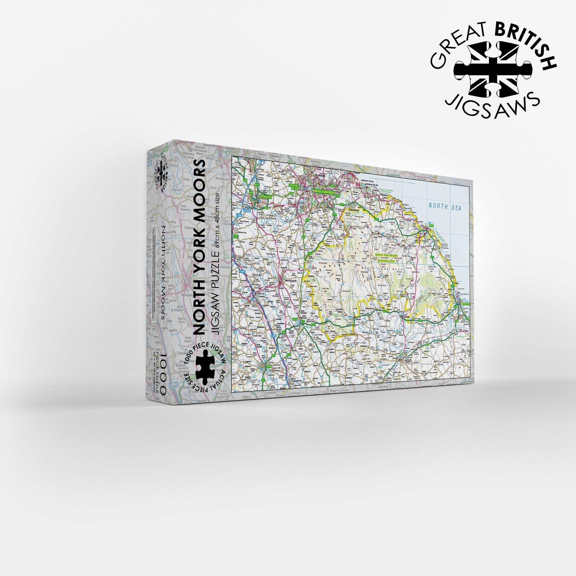
North York Moors Map 1000 Piece Jigsaw
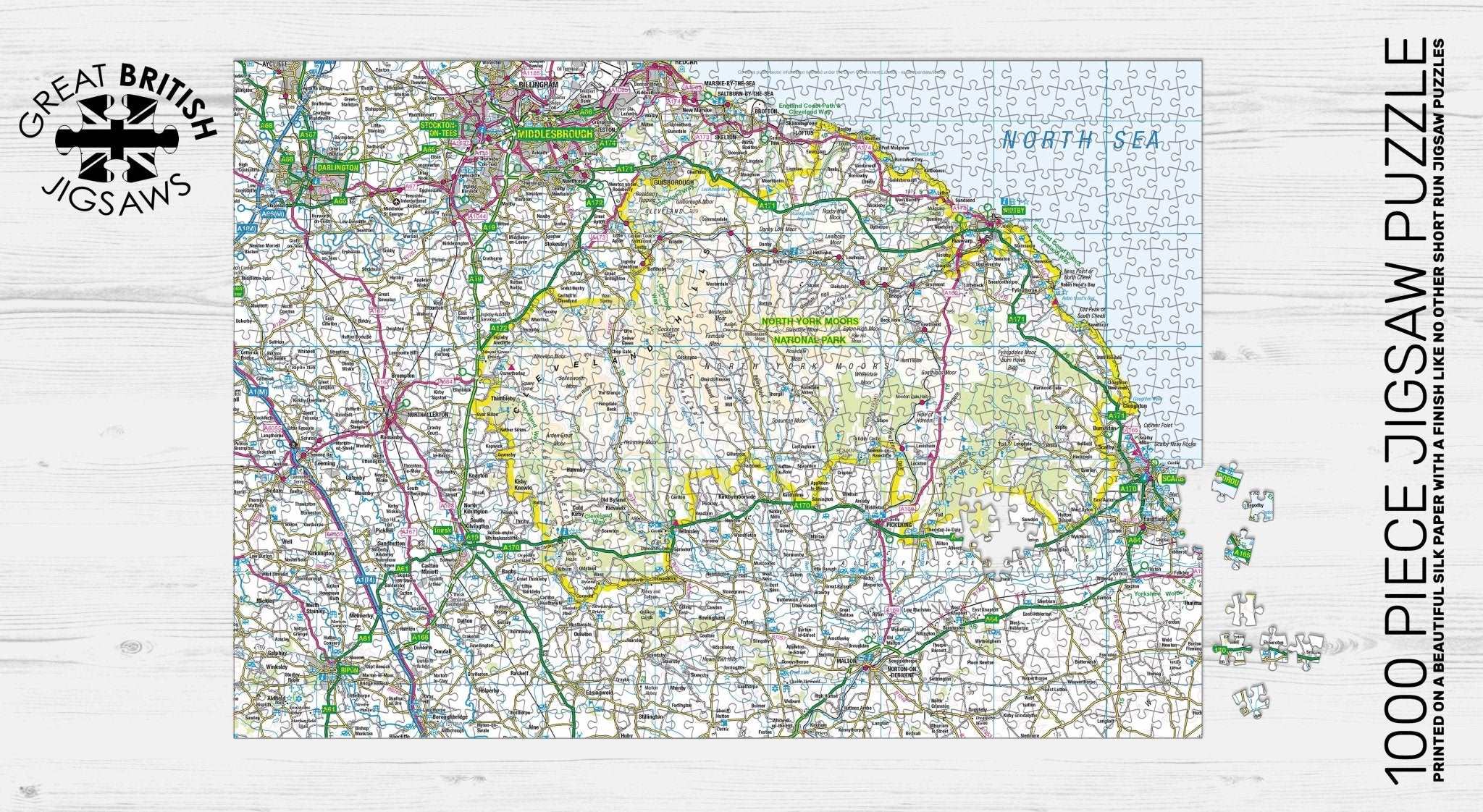
Experience the breathtaking beauty of the purple heather moors with the Pieceful Maps North York Moors 1000 Piece Jigsaw Puzzle. Located in North Yorkshire, this National Park is famous for containing one of the largest expanses of heather moorland in the United Kingdom. This Ordnance Survey map jigsaw allows you to explore the 554 square mile park in intricate detail, using a scale specially chosen to fit the entire North York Moors National Park boundary onto a single puzzle. You get a complete overview of this diverse landscape, packed with hundreds of place names, roads, rivers, and coastal features. The scale is the same as a standard roadmap, so you will see the major routes and settlements, but not the hyper-detailed footpaths and contours that walkers might need on the ground. That makes this puzzle a fantastic challenge for map lovers who want to see the big picture.
As you work through the 1000 pieces, you will travel from the dramatic coastal cliffs near Robin Hood’s Bay, across the rugged moorland interior, and through the wooded valleys of Rosedale and Farndale. The Ordnance Survey mapping clearly shows the two distinct parts of the park. To the north, the moorland plateau is dissected by deep, glacially formed dales. To the south, the land slopes down to the Vale of Pickering, a fertile agricultural plain. You will see the Cleveland Way National Trail marked on the map, a long-distance path that skirts the edge of the moor and follows the coast.
The puzzle includes all the major roads, such as the A169 that crosses the moor from Pickering to Whitby and the A171 that runs along the northern edge. You will spot the charming towns and villages of Helmsley, with its castle, and Hutton le Hole, home to the Ryedale Folk Museum. The map also shows the North Yorkshire Moors Railway, a historic steam railway that runs from Pickering to Grosmont, passing through the heart of the park. That railway line is clearly marked, a delight for train enthusiasts who will enjoy piecing together its winding route.
The Ordnance Survey mapping captures the unique geology and the vast Sites of Special Scientific Interest that make this area vital for wildlife, including merlins, golden plovers, and the rare bilberry bumblebee. As you assemble the puzzle, you will see the boundaries of the park and how it meets the coast at the famous town of Whitby, with its abbey ruins perched on the cliff top. The scale ensures that the whole park fits neatly onto the 1000 pieces, measuring 69cm by 48cm when completed. It is a fantastic gift for anyone who loves walking on the moors, riding the steam train, or simply admiring the landscape from the warmth of their living room. Contains public sector information licensed under the Open Government Licence.
Measures: 69cm x 48cm when completed
Contains public sector information licensed under the Open Government Licence – os.uk/opendata/licence
| Weight | 0.5 kg |
|---|