


Eryri National Park (Snowdonia) 1000 Piece Jigsaw
Conquer the highest peaks in Wales with the Pieceful Maps Eryri National Park 1000-Piece Jigsaw Puzzle. Officially known as Eryri, this mountainous region in North Wales is a land of dramatic ridges, picturesque lakes, and rugged slate quarries. This map jigsaw uses official Ordnance Survey mapping, with a scale carefully chosen to fit the entire Snowdonia National Park boundary onto a single puzzle. You get a complete overview of this 2,142 square kilometre landscape, packed with hundreds of place names, roads, rivers, and mountain features. The scale is the same as a standard roadmap, so you will see the major routes and settlements, but not the hyper-detailed footpaths and contours that walkers might need on the ground. That makes this puzzle a fantastic challenge for map lovers who want to see the big picture of this vast and complex park.
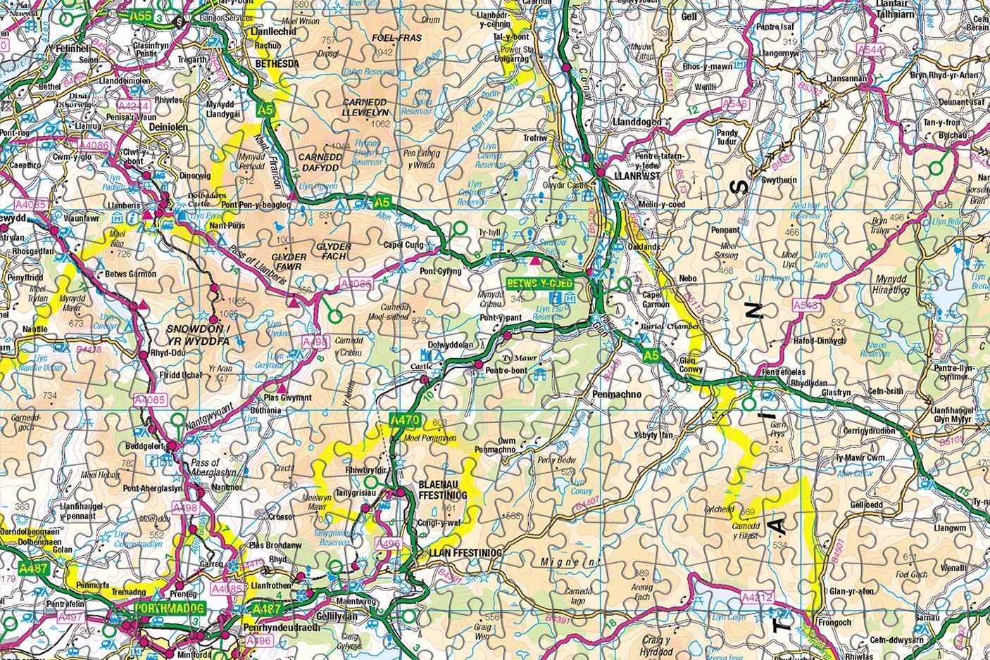
As you piece together the 1000 pieces, you will climb the slopes of Yr Wyddfa, the highest mountain in Wales and England at 1,085 metres. The Ordnance Survey mapping clearly shows the nine mountain ranges that make up the park, including the Glyderau, the Carneddau, and the Moelwynion. You will trace the ridges and valleys that have been carved by glaciers, and you will spot the many lakes, known as llyns, that fill the hollows. The map also shows the dramatic coastline of the Llyn Peninsula, which is part of the park, with its sandy beaches and rugged headlands.
The puzzle includes all the major roads, such as the A5 that runs through the heart of the park from Betws-y-Coed to Capel Curig and the A470 that follows the Conwy Valley. You will spot the charming towns and villages of Betws y Coed, known as the gateway to Snowdonia, and Beddgelert, with its legendary grave of Gelert the dog. The map also shows the historic slate quarries at Llanberis and Blaenau Ffestiniog, which are a UNESCO World Heritage Site, and the narrow-gauge railways that once carried slate to the coast.
The Ordnance Survey mapping captures the rugged beauty of the Welsh mountains, from the sharp peaks of Tryfan to the knife-edge ridge of Crib Goch. The scale ensures that the whole park fits neatly onto the 1000 pieces, measuring 69cm by 48cm when completed. This is a perfect puzzle for walkers, climbers, and anyone who has ever stood in awe of the Welsh mountains. It provides a relaxing way to plan your next route or relive your favourite hike, all from the comfort of your living room. Contains public sector information licensed under the Open Government Licence.
Measures: 69cm x 48cm when completed
Contains public sector information licensed under the Open Government Licence – os.uk/opendata/licence
| Weight | 0.5 kg |
|---|


