


Tourism Photography
I have lived and worked in the Peak District for most of my adult life. I know its hills and moors and woodlands like the back of my hand, and I love to explore it in every season, weather and mood. This experience means that I know how best to use the Peak District landscape to help you market your venture.

Outdoor & Brand Photography
I have worked with a wide range of leading brands, combining the beauty of the Peak District landscape with the very best in outdoor photography to create stunning, memorable images. My clients have included Patagonia, AllTrails, Forme Bikes, Ramblers Worldwide Holidays, Peak Cottages and more..

Professional Photography Services in the Peak District
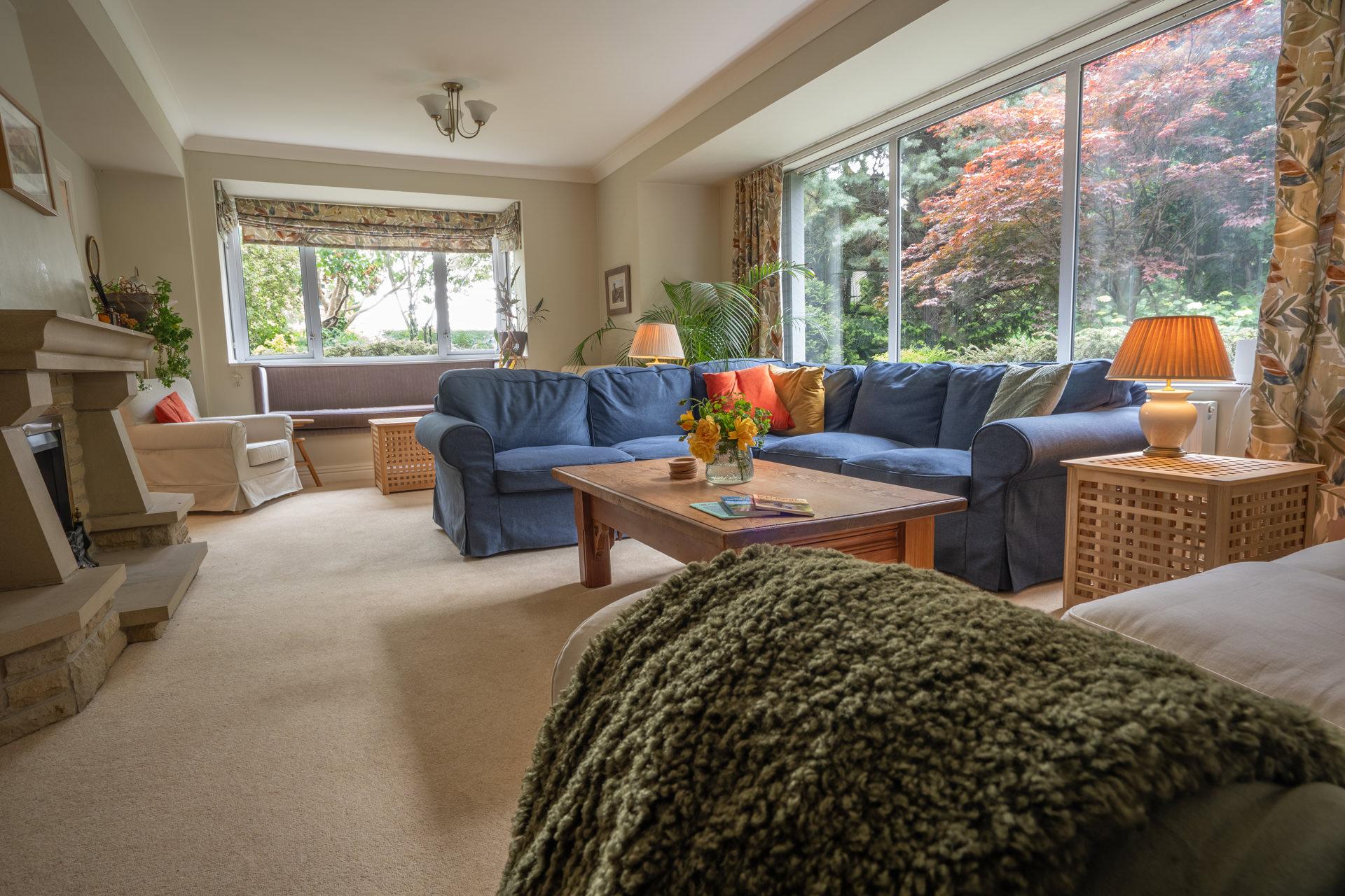
Based in the heart of the Peak District National Park, I provide specialist photography services for the tourism, property, and commercial sectors. Whether you require compelling images of holiday accommodation, destination-led content for a tourism campaign, or professional brand photography, I bring a deep understanding of this landscape to every commission.
I work with holiday cottage owners, hotels, tourism bodies and lifestyle brands to create imagery that drives engagement and bookings. My experience includes commissions for BBC Countryfile Magazine, the YHA, Patagonia, AllTrails, Ramblers Worldwide Holidays, and Haddon Hall, alongside long-standing partnerships with local property agencies and hospitality businesses.
My approach is friendly, efficient, and tailored to your needs. Every image is carefully hand-edited to ensure consistency, quality, and a final result that exceeds expectations. Having lived and worked in the Peak District for most of my adult life, I know how to capture the character of a property, the atmosphere of a location, and the authenticity that today’s audiences respond to.
Specialist Services Include:
- Property Photography – for holiday cottages, hotels, pubs with rooms, and glamping sites
- Destination & Tourism Photogr//aphy – commissioned work for visitor economies, attractions, and place-based marketing
- Brand, Press & Commercial Photography – outdoor brands, editorial features, and lifestyle content
Explore examples of my recent commissions to see the quality and breadth of my work. From intimate interiors to expansive landscape backdrops, each project is approached with the same attention to detail and commitment to storytelling.
Peak District Photography Products
In addition to commissioned work, a selection of my landscape photography is available as limited-edition prints, greeting cards, jigsaw puzzles, calendars, and a dedicated coffee table book. These make distinctive gifts or additions to holiday properties looking to offer guests a lasting memento of the Peak District.
To discuss your next project, or to arrange a consultation, please get in touch.
Phil Sproson Photography: Immortalising the Peak District’s Beauty
Established in 2014, Phil Sproson Photography is a landscape photography company that is situated in the heart of the Peak District. Specialising in capturing the awe-inspiring essence of this picturesque National Park, Phil creates a diverse array of tangible products for everyone to enjoy. As a skilled and passionate photographer, he draws endless inspiration from the captivating landscapes of the countryside that surrounds him.
Phil Sproson’s profound love for the outdoors and the Peak District led him on a journey to share the area’s striking landscapes, vivid colours, and abundant wildlife with others. His artistic vision and dedication to encapsulating the areas natural beauty have earned him a loyal following among photography aficionados and Peak District enthusiasts.
Phil’s photography masterfully illustrates the remarkable diversity and richness of the Peak District, chronicling the shifting seasons, dramatic weather, and distinctive landscape features. From serene, rolling hills and idyllic valleys to rugged, windswept moors and impressive gritstone edges, his photographs capture the spirit of the region, resonating with both locals and visitors.
To make his work available to a broader audience, Phil has extended his business beyond photographic prints, offering a variety of premium products showcasing his exceptional images. These products include jigsaws, greeting cards, the highly coveted Peak District Calendar, and a visually striking coffee table book that highlights the region’s splendour. Each product is meticulously designed and crafted to ensure it truly reflects the Peak District’s enchanting beauty.
The jigsaw puzzles, offer a unique and interactive way for people to engage with Phil’s images, immersing themselves in the vivid landscapes as they assemble the scenes. These puzzles make perfect gifts, fostering a sense of connection and appreciation for the natural world.
Phil’s greeting cards, which display a selection of his most popular images, present a fantastic opportunity for customers to share a piece of the Peak District with their loved ones, whether for special occasions or simply to brighten someone’s day.
The annual Peak District Calendar is essential for those who admire the region’s beauty. It serves as a visual journey through the seasons, with each month featuring a captivating image that embodies the essence of that time of year. The calendar is both practical and visually stunning, making it an ideal gift or personal memento.
Phil Sproson Photography transcends mere business; it is a heartfelt celebration of the Peak District’s captivating beauty. Through his work, Phil invites you to discover, appreciate, and treasure the enchanting landscapes of the region, forever preserved in his extraordinary photographs and distinctive products.

See You at My Next Event?
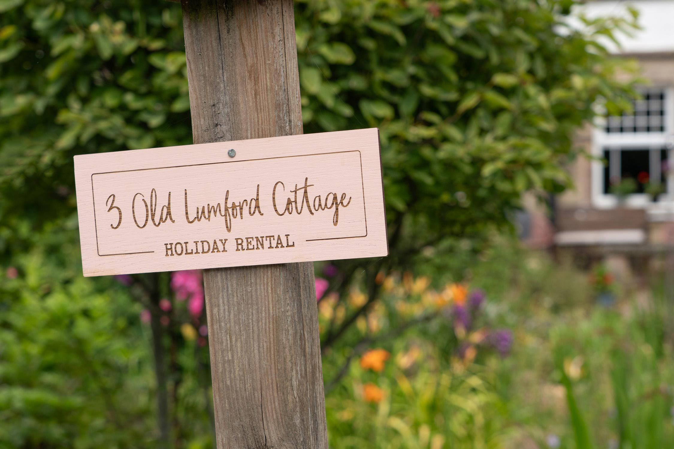
A Picture-Perfect Launch: Professional Airbnb Photography for 3 Old Lumford Cottage, Bakewell
First Impressions on the River Wye When a new holiday let enters the bustling Peak District market, its online debut is everything. In a region where stone cottages, rolling dales, and chocolate-box villages compete fiercely for attention, the scroll-stopping power of a photograph can make or break a booking calendar. This was precisely the challenge faced by Danielle, the [...]
How Photography and a Bespoke Website Helped Westhills Courtyard
Westhills Courtyard A few miles from Bakewell, tucked away on a quiet equine farm near the village of Winster, sits a pair of holiday cottages that quietly embody everything a Peak District escape should be. Westhills Courtyard is the kind of place that feels discovered rather than advertised. Yet over the past few years it has earned a loyal [...]
10 Tourism Photography Mistakes Costing You Bookings
Discover 10 tourism photography mistakes costing Peak District holiday properties and tourism businesses real bookings, plus how to fix each one.

Property Photography ROI: Is It Worth It for Holiday Lets?
Is professional property photography worth it for your holiday let? Use our ROI calculator with real Peak District numbers to see the payback period.

From Camera Roll to Guest Favourite
From Camera Roll to Guest Favourite: How Professional Photography Filled a Victorian Hideaway’s Summer Bookings in two weeks! Let me paint you a picture. Not the kind you scroll past on your phone, but the kind that makes someone stop, click ‘book’, and rearrange their entire weekend around a log burner and a south-facing garden. I recently had the [...]
Property Photography Bookings
How professional property photography increased Peak District holiday cottage bookings by 47%. Real case studies, drone photography insights, and ROI data for property owners.
5 Reasons Holiday Property Websites Need Regular Photography Updates
Discover 5 reasons why regular property website photography updates are essential for holiday rental bookings, SEO, and guest trust in 2024.

Outdoor Brand Photography in the Peak District
Discover how outdoor brand photography using Peak District landscapes as your studio delivers authentic commercial imagery that generic locations cannot match.

Peak District 2027 Calendar: A Monthly Journey Through Stunning Landscapes
A Year in the Peak District: Exploring Phil Sproson's 2027 Calendar The Peak District holds a special place in the heart of British landscapes. Spanning parts of Derbyshire and beyond, it was the first of Britain's national parks, designated in 1951. Its dual personality is captured perfectly in the White Peak of the south, with its rolling limestone plateau, [...]
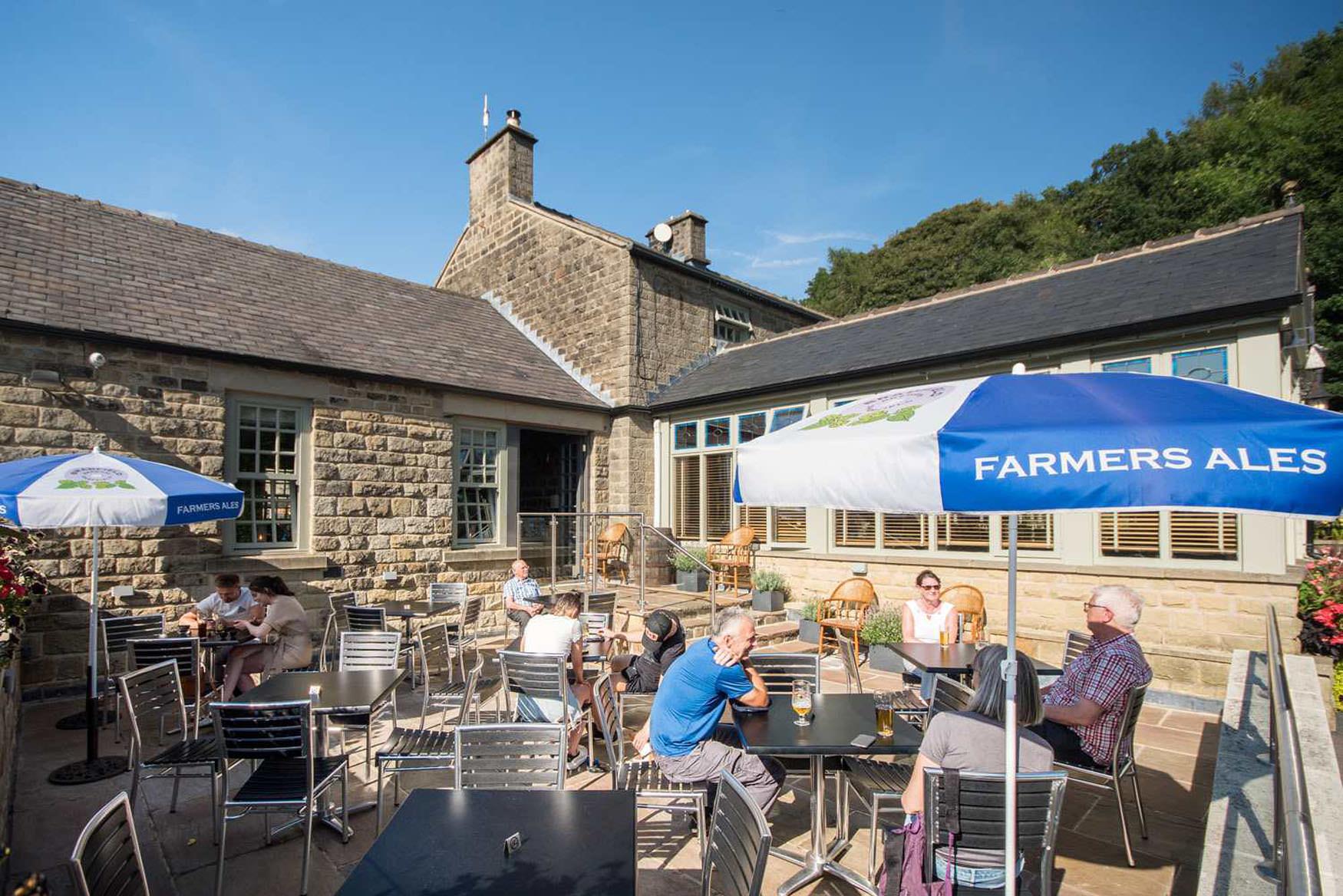
Pub Photography: Showcase Your Venue and Fill More Seats
Professional pub photography drives bookings for Peak District venues. Learn how commercial property photography transforms how guests discover and choose your pub or restaurant.
