A Year in the Peak District: Exploring Phil Sproson’s 2027 Calendar
The Peak District holds a special place in the heart of British landscapes. Spanning parts of Derbyshire and beyond, it was the first of Britain’s national parks, designated in 1951. Its dual personality is captured perfectly in the White Peak of the south, with its rolling limestone plateau, deep dales and dry-stone walls, and the Dark Peak of the north, a wilder, more brooding terrain of millstone grit edges, vast expanses of heather moorland and blanket peat bogs.

For landscape photographer Phil Sproson, this diverse terrain has been a source of inspiration for decades. Based in the heart of the national park, his work is a visual love letter to its changing moods and seasons. His Peak District 2027 Calendar is more than a way to mark the days. It is a guided tour through twelve of his most captivating images, a testament to the places that inspire him. Unique to this calendar is the inclusion of what3word addresses for each location, inviting users to not just admire the view but to go and discover it for themselves. What follows is a journey through that calendar, a month by month exploration of the wild and rugged charm of the Peak District.

January: The Sheepwash Bridge at Ashford-in-the-Water in the Snow ///bordering.domain.aware (SK194696)
The year begins in the quintessentially English village of Ashford-in-the-Water, its name a poetic nod to the shallow ford across the River Wye and the ash trees that once lined its banks. The January image captures its crown jewel, the medieval Sheepwash Bridge, rendered even more picturesque under a blanket of snow. This ancient, low-arched packhorse bridge, dating from the 17th century, is one of the most photographed in the country. The attached stone sheepfold, where lambs were once penned so their mothers would swim across the river to reach them, is a scheduled ancient monument. While the practice has long ceased, this winter composition strips the scene back to its essence. The quiet, stillness of a snowy January day is broken only by the dark, clear water of the Wye flowing beneath the ancient stone arches. It is an image of profound peace, capturing a village which has charmed visitors for centuries, nestled on a river known for its crystal-clear waters.
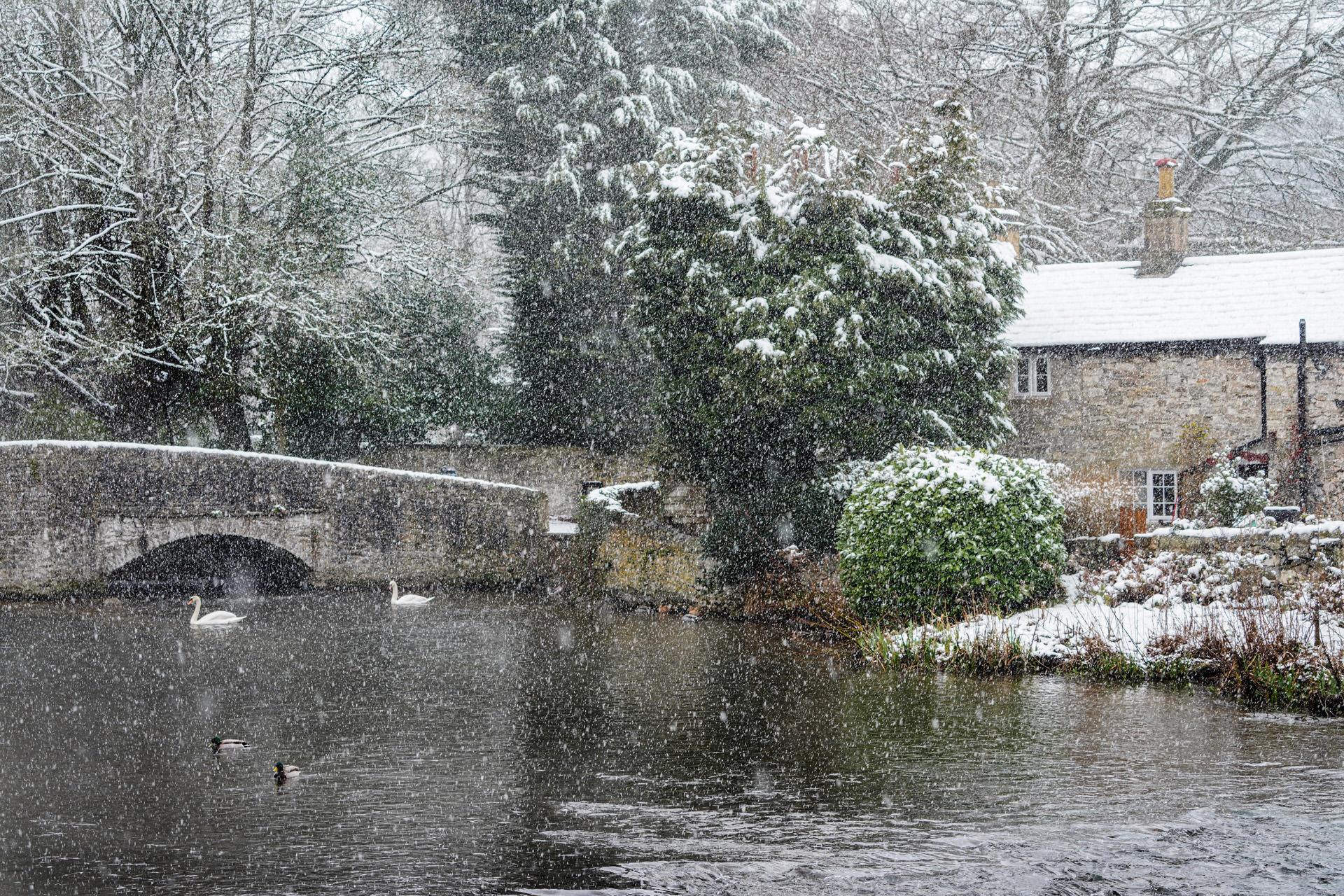
Peak District Calendar 2027 – January
February: The Prettiest Lane above Grindleford ///daylight.eventful.folds (SK235784)
For February, the calendar moves north to a scene of intimate, quiet beauty: Leam Lane, above Grindleford. The image captures the lane in winter – bare-branched trees lining the path, with a soft, muted light and mist that gives the scene a gentle stillness. The photograph for this month serves as an invitation to explore the quieter corners of the national park. It reminds us that beauty is not always found on the high, open moors, but can be discovered along a forgotten lane where the view unfolds gently with every step.
Peak District Calendar 2027 – February
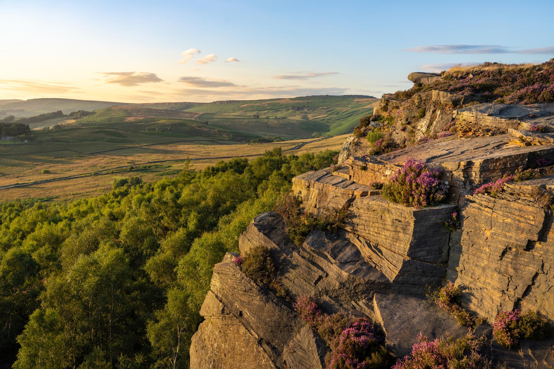
March: A Stormy Sunset at Carhead Rocks ///places.rocky.shapes (SK240829)
As winter begins to loosen its grip, March’s photograph captures the first hints of the drama to come with a stormy sunset at Carhead Rocks. This location, a miniature gritstone edge tucked below the far more famous Stanage Edge, offers one of the most spectacular vantage points in the Hope Valley. The image uses the millstone grit edge and iconic Knuckle Stone to frame the setting sun as it casts a warm glow. The view stretches out over Hathersage and encompasses landmarks like Win Hill, Lose Hill and Mam Tor. It is a scene of dynamic contrast. Carhead Rocks is a favourite among photographers precisely for moments like this, where the weather and light conspire to create a fleeting masterpiece.
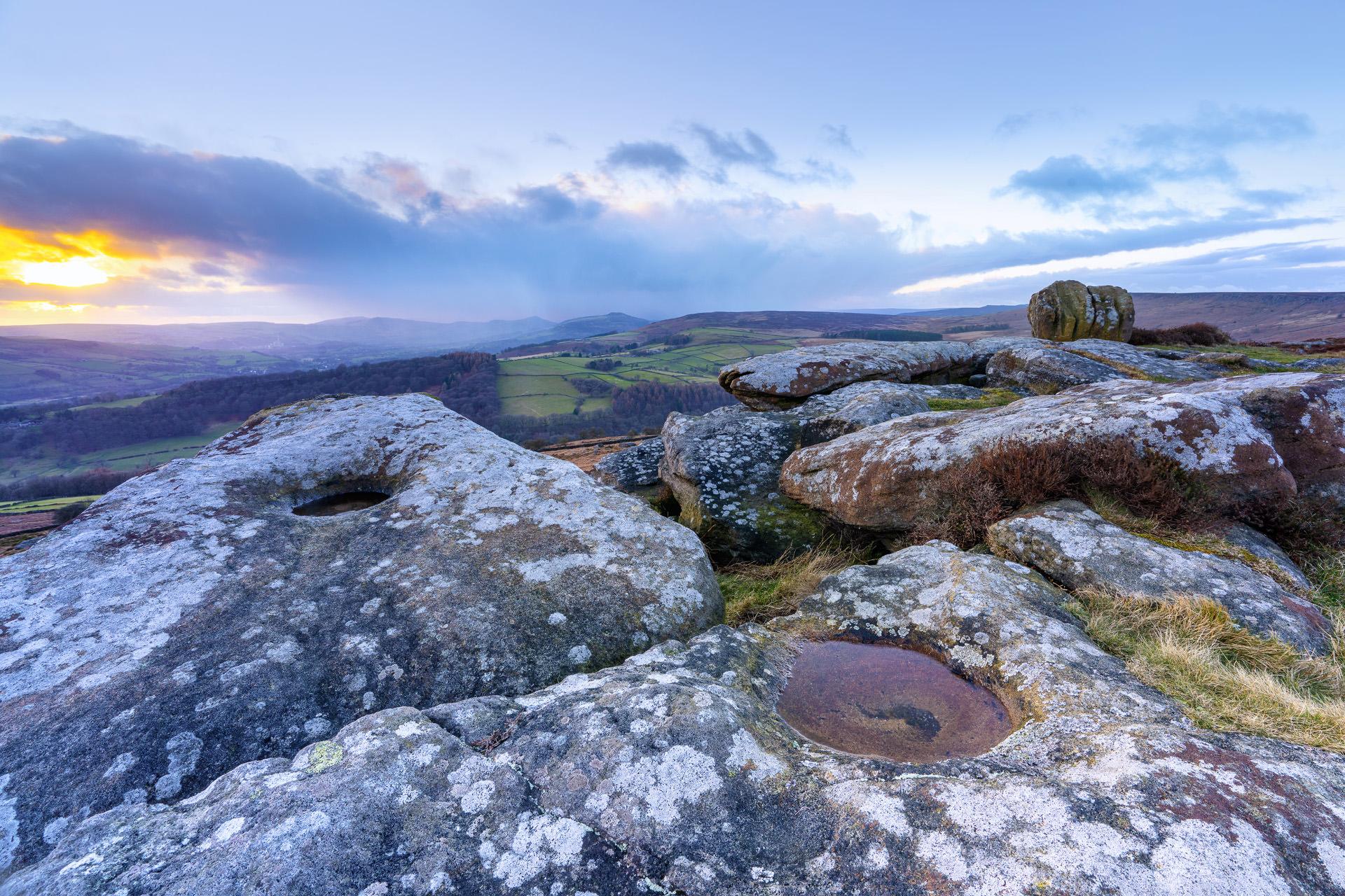
Peak District Calendar 2027 – March
April: White Peak Barn at Sunrise ///areas.envoy.camera (SK187642)
April’s image marks a shift in tone to the gentler, pastoral landscapes of the White Peak with a barn near Youlgrave at sunrise. Youlgrave, also known as Youlgreave, sits on a limestone shelf above Bradford Dale, and the surrounding countryside is a network of traditional farms and dry-stone walls. The photograph captures the first rays of an early spring sun illuminating an old stone barn, a building that stands as a testament to the area’s long agricultural heritage. This part of the Peak District, where fields are interspersed with ancient trackways and wildflower-rich dales, is the very essence of rural England. It is a quiet celebration of the simple, enduring structures that have become as much a part of the landscape as the hills themselves, capturing the unique character of the White Peak as it stirs to life.
Peak District Calendar 2027 – April
May: Kinder Downfall ///magma.practical.calibrate (SK083889)
From the sleepy pastures of Youlgrave, May’s photograph dramatically shifts focus to the wild, windswept plateau of Kinder Scout, featuring its crowning spectacle: Kinder Downfall. At 30 metres, this is the tallest waterfall in the Peak District, and as the image shows, it is a force of nature. In the context of spring and the gradual thaw, the downfall is often at its most thunderous. The walk to this point is a rite of passage for any Peak District hiker, often starting from the nearby village of Hayfield and climbing up onto the vast, trackless moor of Kinder, whose highest point reaches 636 metres. The image captures more than just the waterfall. It captures the spirit of the Dark Peak, which is elemental, raw and challenging. For many, this is the heart of the national park, a place that inspired the mass trespass of 1932 and continues to inspire all who make the pilgrimage to its edge.
Peak District Calendar 2027 – May
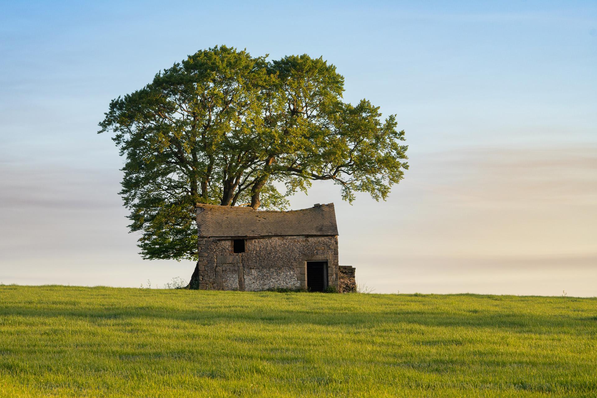
June: A Derelict Barn near Sheldon ///cool.shippers.tungsten (SK173677)
June’s photograph returns to the White Peak, but with a touch of poignant history. The image features a derelict barn near the isolated upland village of Sheldon. Perched at 1,000 feet, Sheldon is a village whose history is deeply entwined with the land, and particularly with the now-silent lead mining industry. Constructed from traditional stone, it speaks of a harder, more rugged past where such buildings were essential for housing livestock and fodder against the harsh winters. It is an image full of character and a quiet melancholy, a reminder of the transient nature of human industry against the timeless backdrop of the Peaks.
Peak District Calendar 2027 – June
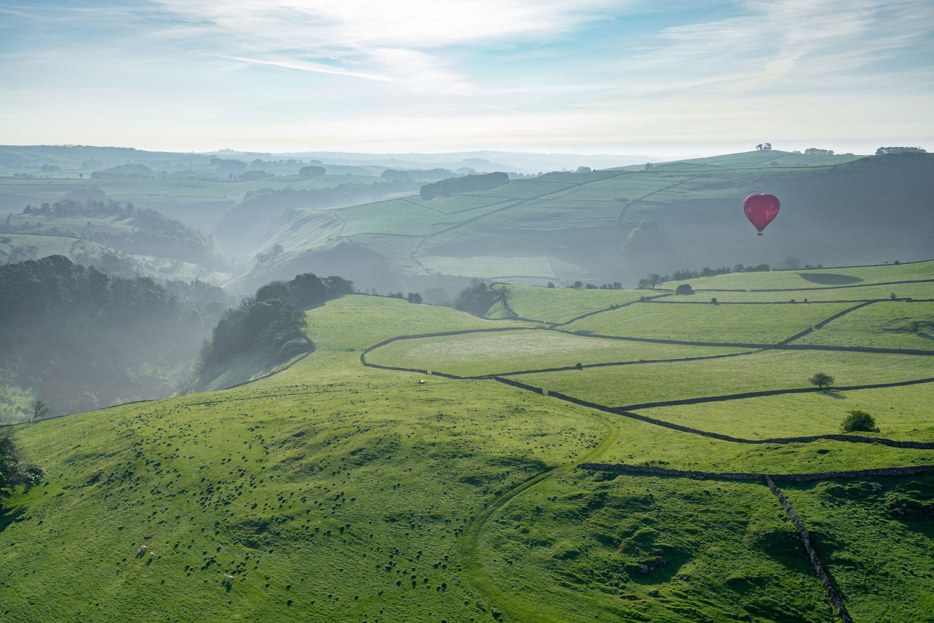
July: Dovedale from a Hot Air Balloon ///nature.bump.highbrow (SK136539)
The calendar takes a breathtaking turn in July with an aerial view of Dovedale, captured from a hot air balloon. This unique vantage point transforms one of the Peak District’s most beloved beauty spots into a graphic, almost abstract landscape. The image reveals the famous dale from above, with the River Dove snaking through it and landmarks like the iconic stepping stones reduced to tiny, charming details. The steep, wooded slopes give way to a patchwork of green pastures, all laid out below like a living map. This perspective communicates the scale of the White Peak’s limestone topography, formed from the compressed remains of ancient sea creatures over 300 million years ago. The experience of floating silently above such a cherished landscape is one of serene detachment, and the photograph perfectly bottles that sense of wonder and freedom. It is a summertime dreamscape, a celebration of the Peak District not just as a place to be walked across, but as a complete, three-dimensional landscape to be gazed upon.
Peak District Calendar 2027 – July
August: Heather in Bloom on Millstone Edge ///skater.tripods.searching (SK248805)
August is synonymous with a single, spectacular sight in the Peak District: the flowering of purple heather, and the calendar showcases the very best of it at Millstone Edge. During this month, the Dark Peak’s gritstone moors are transformed into a sea of vibrant pinks and purples, a sight that is both beautiful and intoxicating. The area below Over Owler Tor and along Millstone Edge is arguably the prime location to witness this floral spectacle, with the lush colour providing a stunning contrast to the dark, weathered millstone grit outcrops.
Peak District Calendar 2027 – August
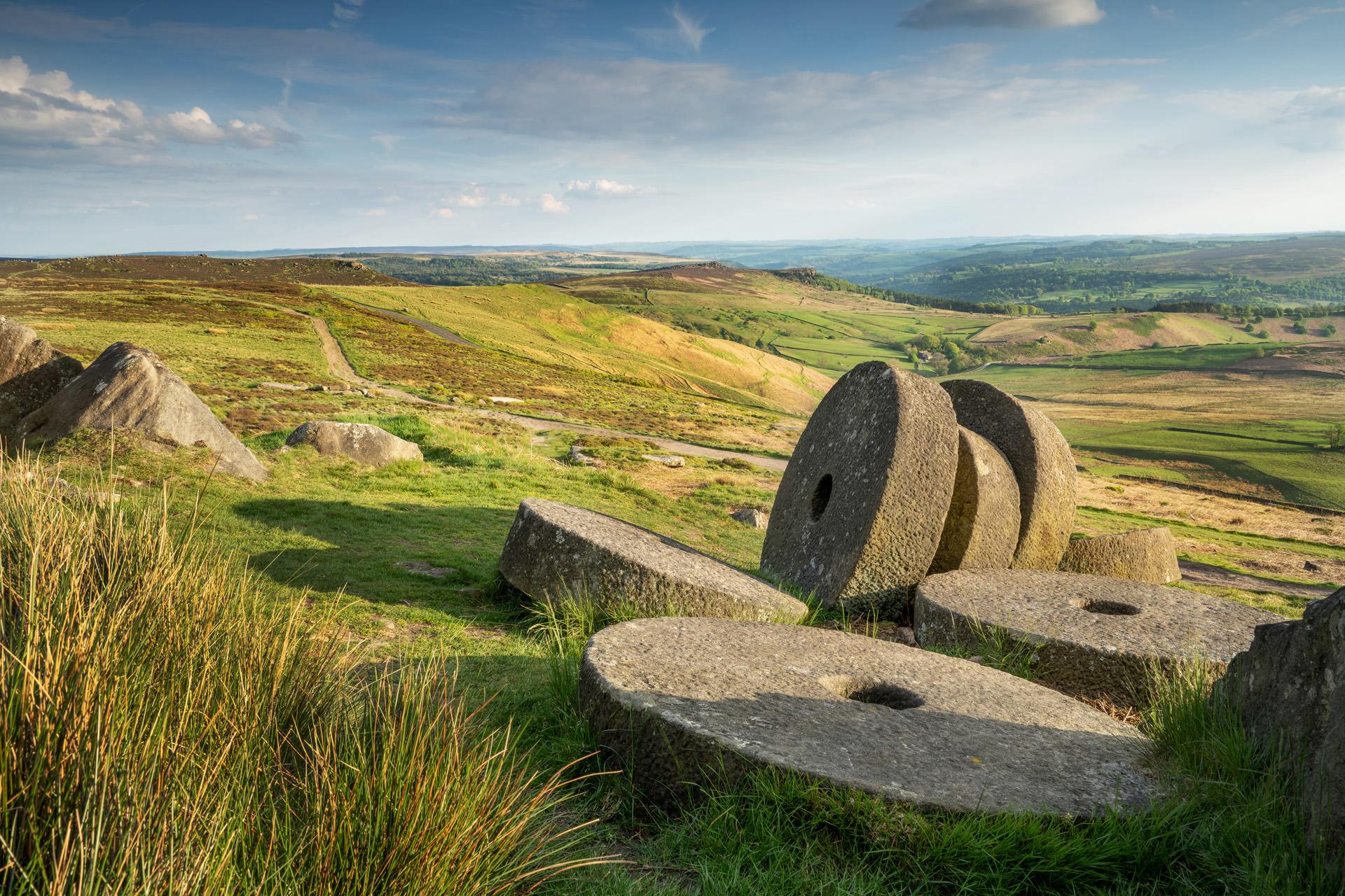
September: The Symbol of the Peak District ///guides.sport.sector (SK250830)
As the heather fades, September’s photograph focuses on a different, more permanent icon: the abandoned millstones of Stanage Edge. These great gritstone wheels, some finished and some still half-carved from the mother rock, are the symbol of the Peak District. The image captures more than a scenic view. It captures the ghosts of a lost industry that once thrived here into the 20th century. The stones were abandoned where they were made, victims of a collapse in demand as new milling technologies emerged. They now lie scattered below the four-mile-long escarpment of Stanage, a dramatic and beloved playground for climbers and walkers. The image presents a powerful juxtaposition. The finite, man-made objects in the foreground stand against the immense, timeless natural landform of the edge itself.
Peak District Calendar 2027 – September
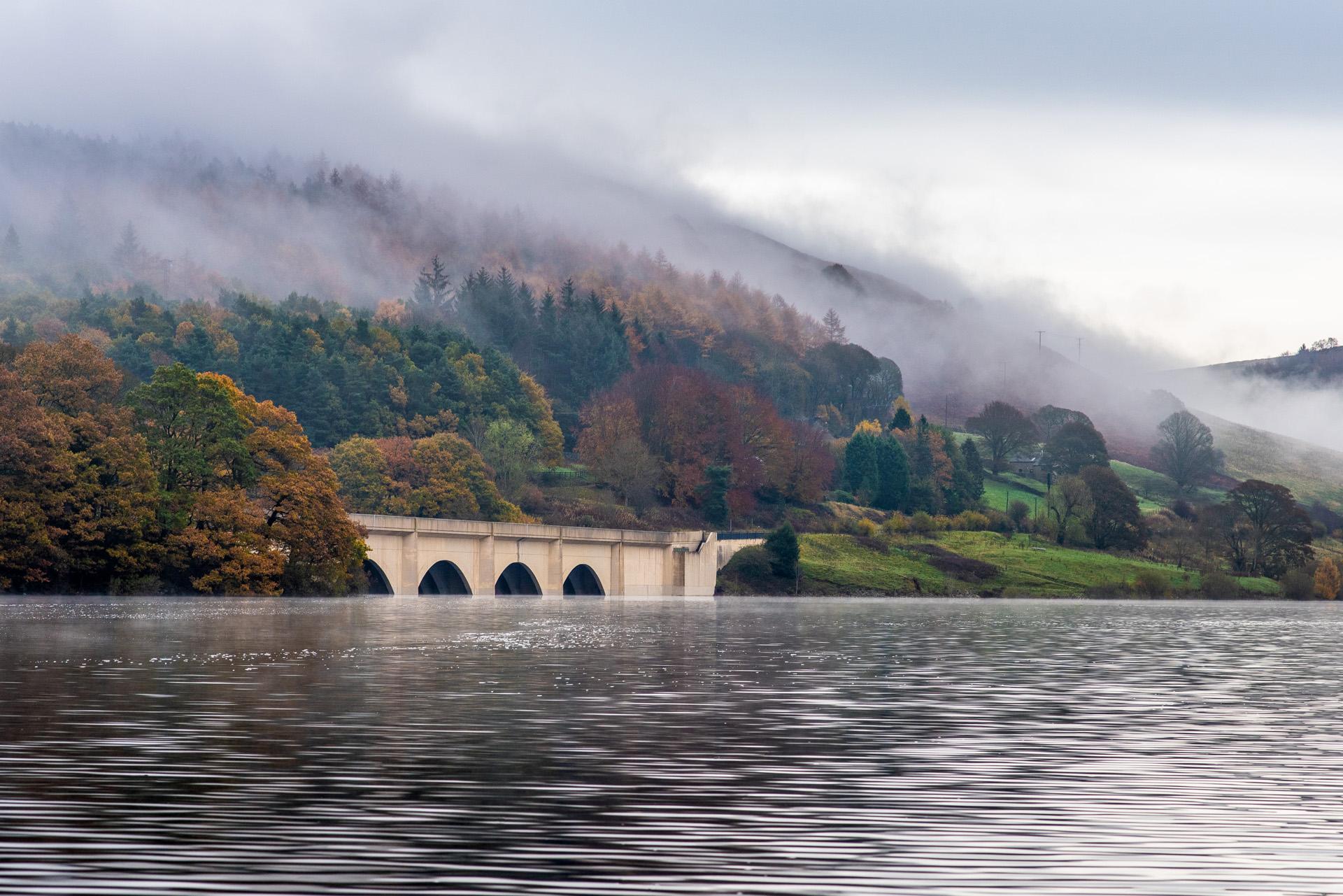
October: On Ladybower ///removing.screen.ripples (SK190863)
October’s image offers a view that few get to experience: the vast expanse of Ladybower Reservoir from a boat, looking towards the majestic Ashopton Viaduct. This Y-shaped reservoir, completed in 1945, is famous for its dramatic history and its serene, mirror-like beauty. The photograph, taken from the water itself, captures the perfect symmetry of the viaduct’s arches, framed by the surrounding woodland and moorland donning their autumn colours. The perspective from a boat adds a unique sense of scale and tranquillity, placing the viewer right in the middle of this iconic landscape. It is an image captures the reservoir not just as a scenic spot, but as an integral part of the Peak District’s man-made landscape.
Peak District Calendar 2027 – October
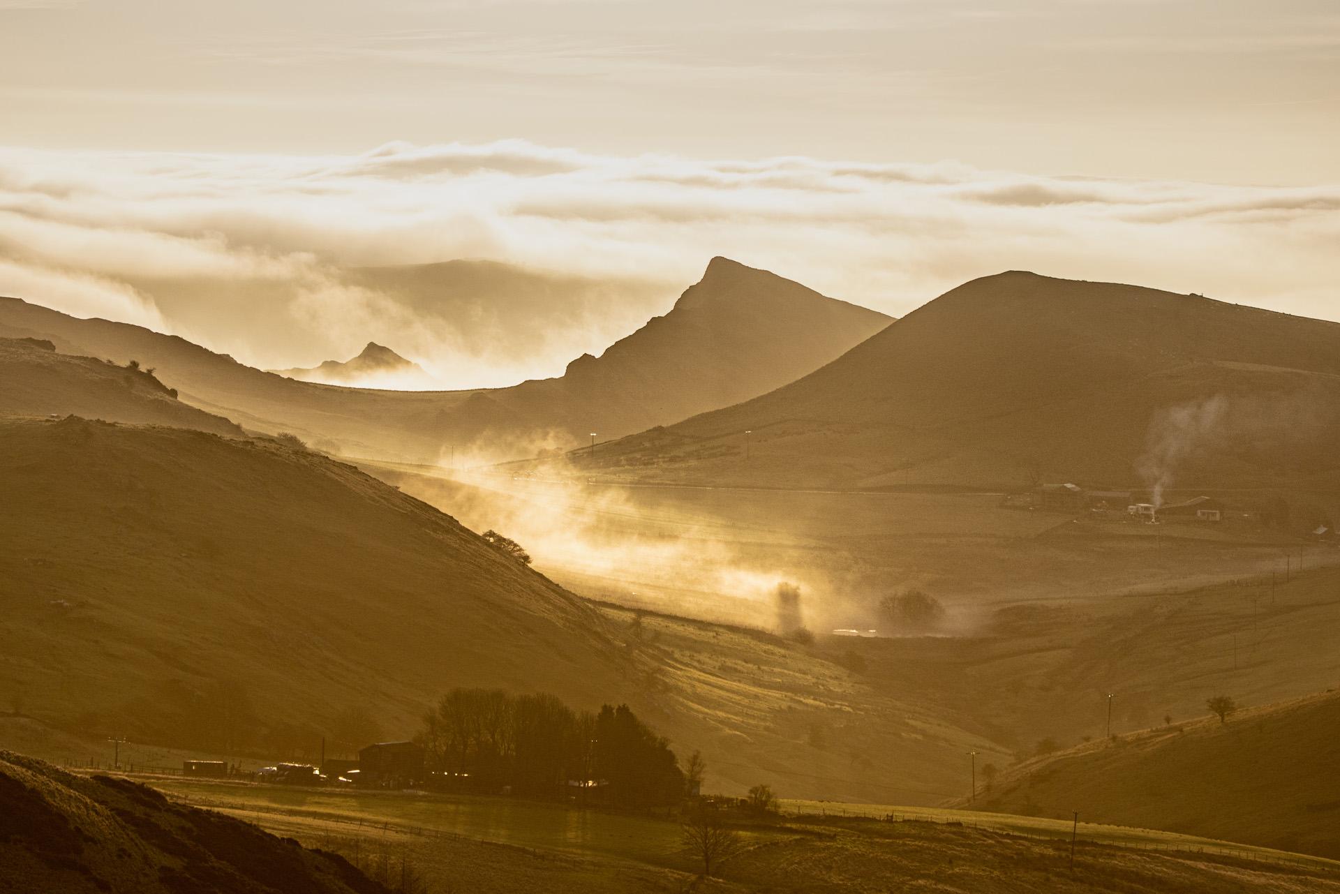
November: Parkhouse and Chrome Hills at Sunrise ///pilots.relished.reset (SK035696)
As autumn deepens, November’s calendar page features one of the most distinctive geological formations in the national park: Parkhouse and Chrome Hills. Captured at sunrise, the photograph illuminates these ancient reefs, remnants of a tropical sea, with the first light of a cold morning. This part of the White Peak, with its limestone geology, offers a different kind of drama than the gritstone edges of the north. This photograph is a testament to the quiet, wild beauty of the Derbyshire Dales, where the ancient history of the earth is written directly on the landscape.
Peak District Calendar 2027 – November
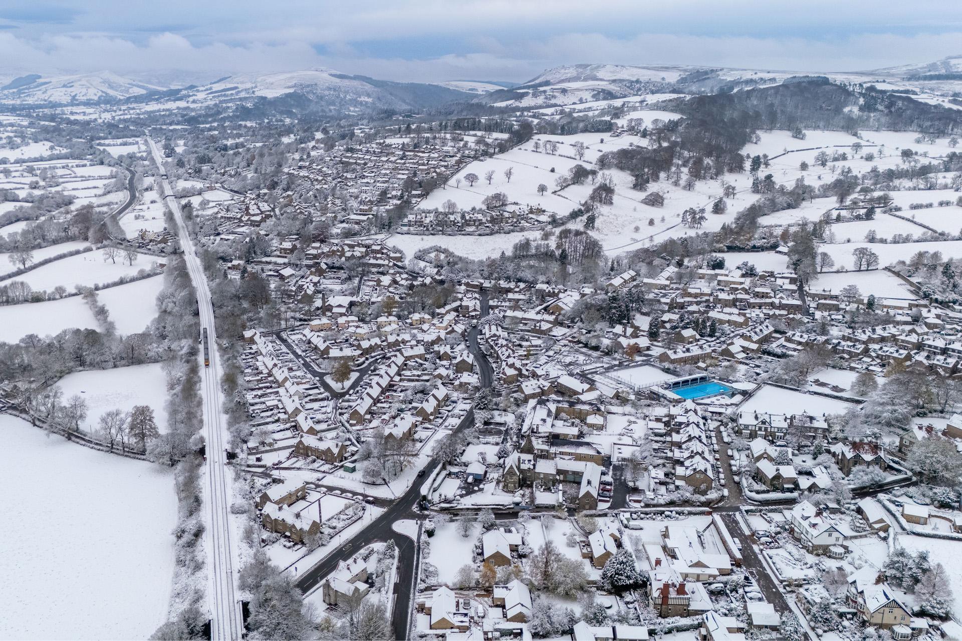
December: Hathersage from Above ///defender.gear.sensitive (SK232810)
The calendar concludes in December with a stark wintery aerial view of Hathersage, captured by drone. In this almost black-and-white snowy landscape, the roads stand out as clear, dark lines. A train moves along the Hope Valley railway line, while the village’s outdoor swimming pool cuts through the monochrome scene as a striking, vibrant blue.
Peak District Calendar 2027 – December