Loch Lomond and The Trossachs Map 1000 Piece Jigsaw
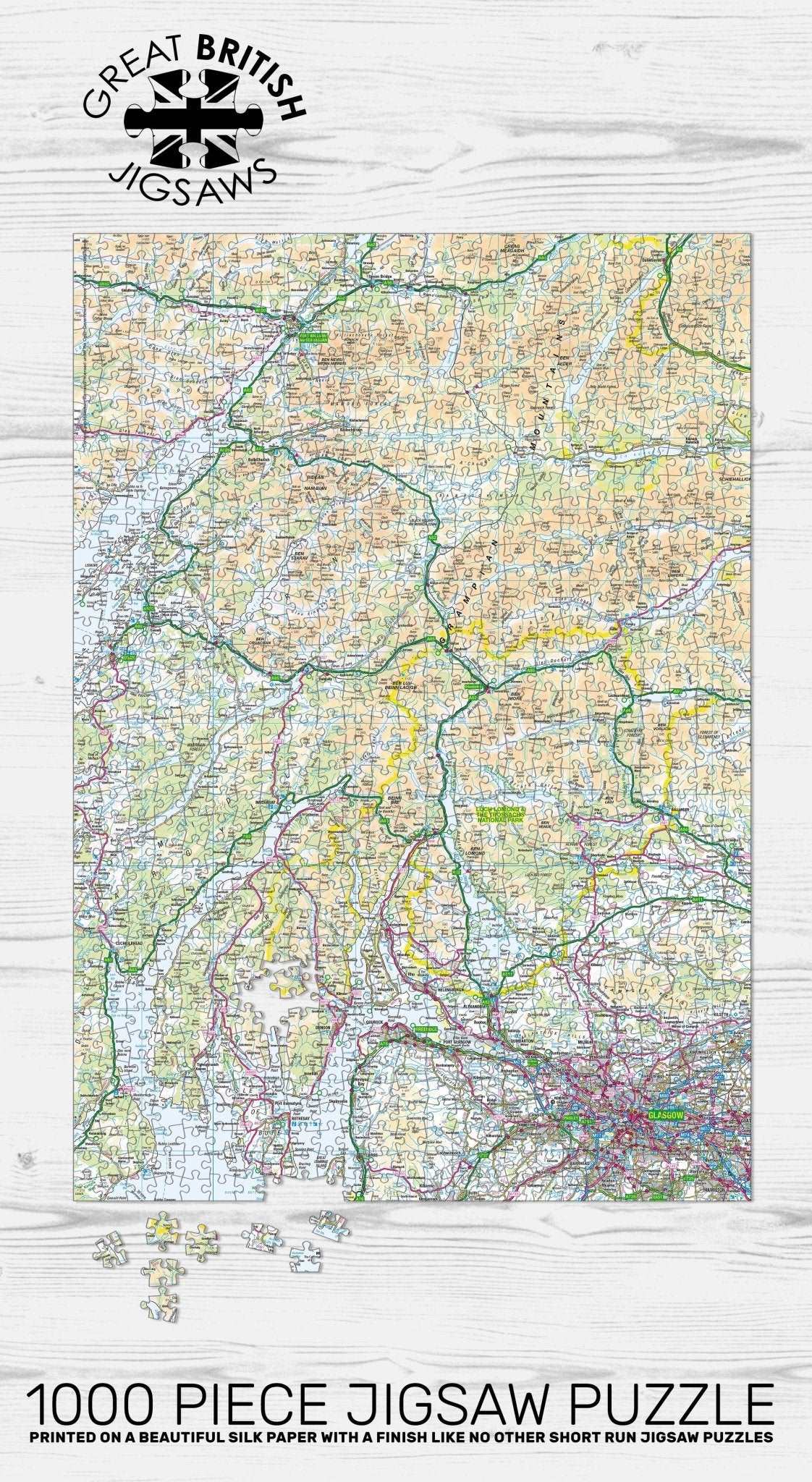
Experience the beauty of Scotland’s first National Park with the Pieceful Maps Loch Lomond and The Trossachs 1000 Piece Jigsaw Puzzle. This is the place where the Scottish Lowlands meet the Highlands, creating a stunning mix of rolling lowland landscapes, tranquil lochs, and rugged northern mountains. This map jigsaw uses official Ordnance Survey mapping, with a scale carefully chosen to fit the entire Loch Lomond and The Trossachs National Park boundary onto a single puzzle. You get a complete overview of this 1,865 square kilometre landscape, packed with hundreds of place names, roads, rivers, and mountain features. The scale is the same as a standard roadmap, so you will see the major routes and settlements, but not the hyper detailed footpaths and contours that walkers might need on the ground. That makes this puzzle a relaxing yet engaging way to discover the beauty of the southern Highlands.
As you piece together the 1000 pieces, you will sail across the waters of Loch Lomond, the largest inland stretch of water in Great Britain by surface area. The Ordnance Survey mapping clearly shows the shape of the loch, with its many islands, including Inchcailloch and Inchmurrin. You will trace the Highland Boundary Fault, a geological line that runs through the park, separating the lowland granite and sandstone from the highland slate and schist. To the north, you will see the towering presence of Ben Lomond, one of the park’s 21 Munros, alongside other peaks like Ben More and Stob Binnein. The map also captures the dramatic glens of the Trossachs, including the famous Pass of Balmaha and the forested shores of Loch Katrine, made famous by Sir Walter Scott’s poem The Lady of the Lake.
The puzzle includes all the major roads, such as the A82 that runs along the western shore of Loch Lomond, and the A84 that leads north to Callander. You will spot the charming towns of Balloch, at the southern tip of Loch Lomond, and Callander, the gateway to the Trossachs. The map also shows the villages of Luss, with its pretty cottages, and Aberfoyle, close to the Queen Elizabeth Forest Park. The West Highland Way, a long distance footpath, follows the eastern shore of Loch Lomond, and at this scale you can trace its route as a line through the landscape.
The Ordnance Survey mapping captures the rich natural and cultural heritage of the park, from the oak woods of the Trossachs to the open hillsides where red deer graze. The scale ensures that the whole park fits neatly onto the 1000 pieces, measuring 69cm by 48cm when completed. This puzzle is a fantastic challenge for jigsaw lovers and a wonderful gift for anyone who has walked the West Highland Way, sailed on Loch Lomond, or simply dreams of visiting the Scottish Highlands. It offers a relaxing way to connect with Scotland’s spectacular scenery. Contains public sector information licensed under the Open Government Licence.
Measures: 69cm x 48cm when completed
Contains public sector information licensed under the Open Government Licence – os.uk/opendata/licence